Travel Map
I realized that everyone in my family (other than me) travel a lot. I wanted to create a map of all their travels.
After curating several attributes initially I finalized the below:
- place
- near-by places
Ignored ones:
- dates, days, duration
- specific places (which temples or places)
- type of travel (fun, religious etc.)
Material
After a week I got hold of Indian political map from the Himalaya Book World in Nampally (location). I’d have loved a higher resolution of the amp but thought this is a good start for a first map.
At the same store I bought double tape, push pins, post-it labels, mount board.
After an hour of mapping with parents we ended up with the map of their travel places.
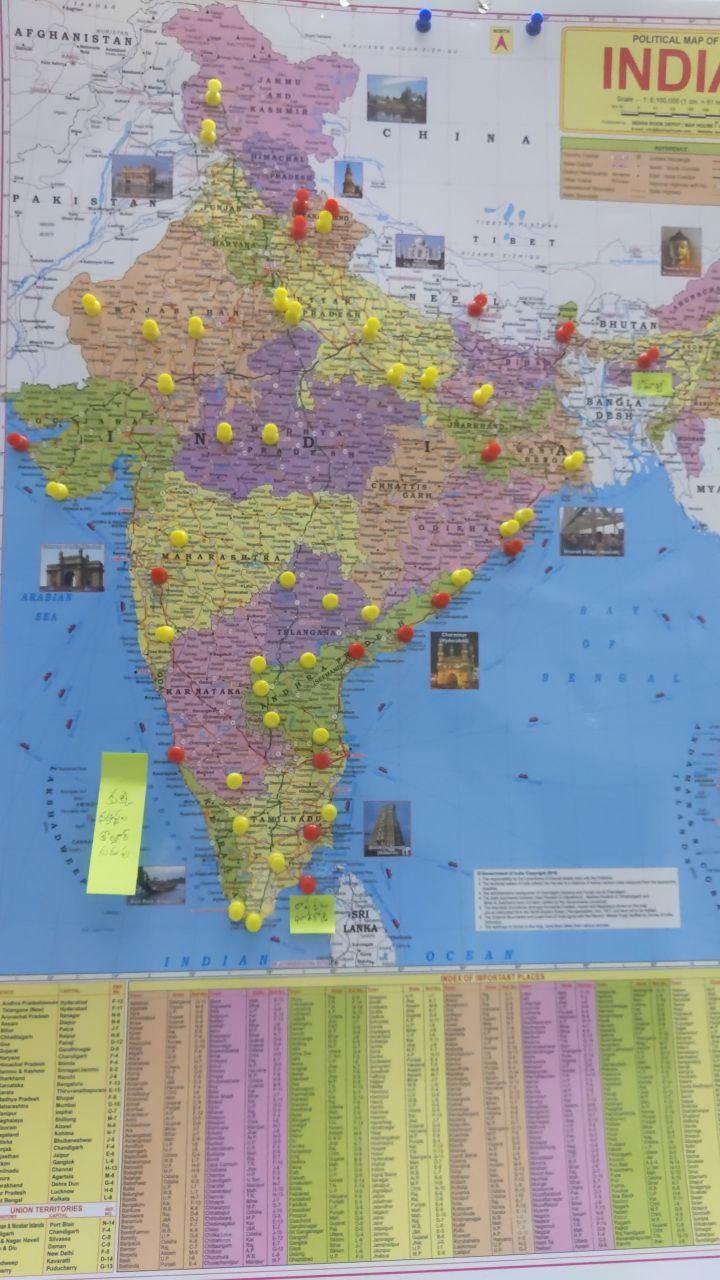
Yellow pins represent visit to a single place/city/town. Rajahmundry and Kakinada are next to each other on the map and couldn’t be represented by two yellow pins due to space issues. Red pins are used for representing visits to such places.
I’d recommend doing this for your travel or for travels with friends. A physical representation of all travels together is of immense joy!
Next iteration
For next iteration of the map I’d love to:
- capture stories from each travel on the map
- create better quality map hopefully with linen fabric
- explore custom styled map printing
- explore alternatives to push pins as it’s easy to get hurt while pinning